Virtual models
Worldwide
Virtual models represent an innovative technological tool that allows the three-dimensional visualisation of architectural, urban and industrial projects. These models offer an immersive and detailed experience, facilitating the understanding and analysis of projects from multiple perspectives.
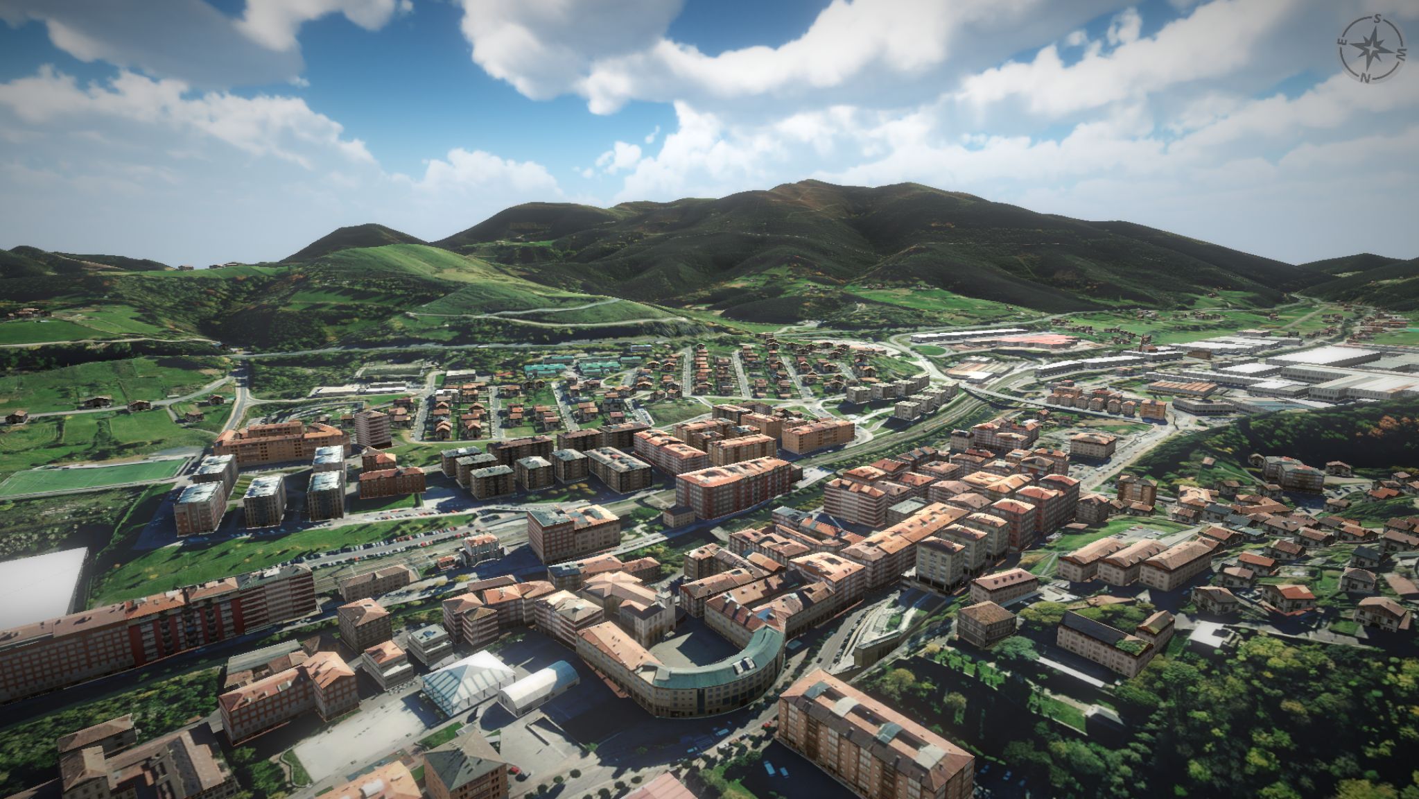
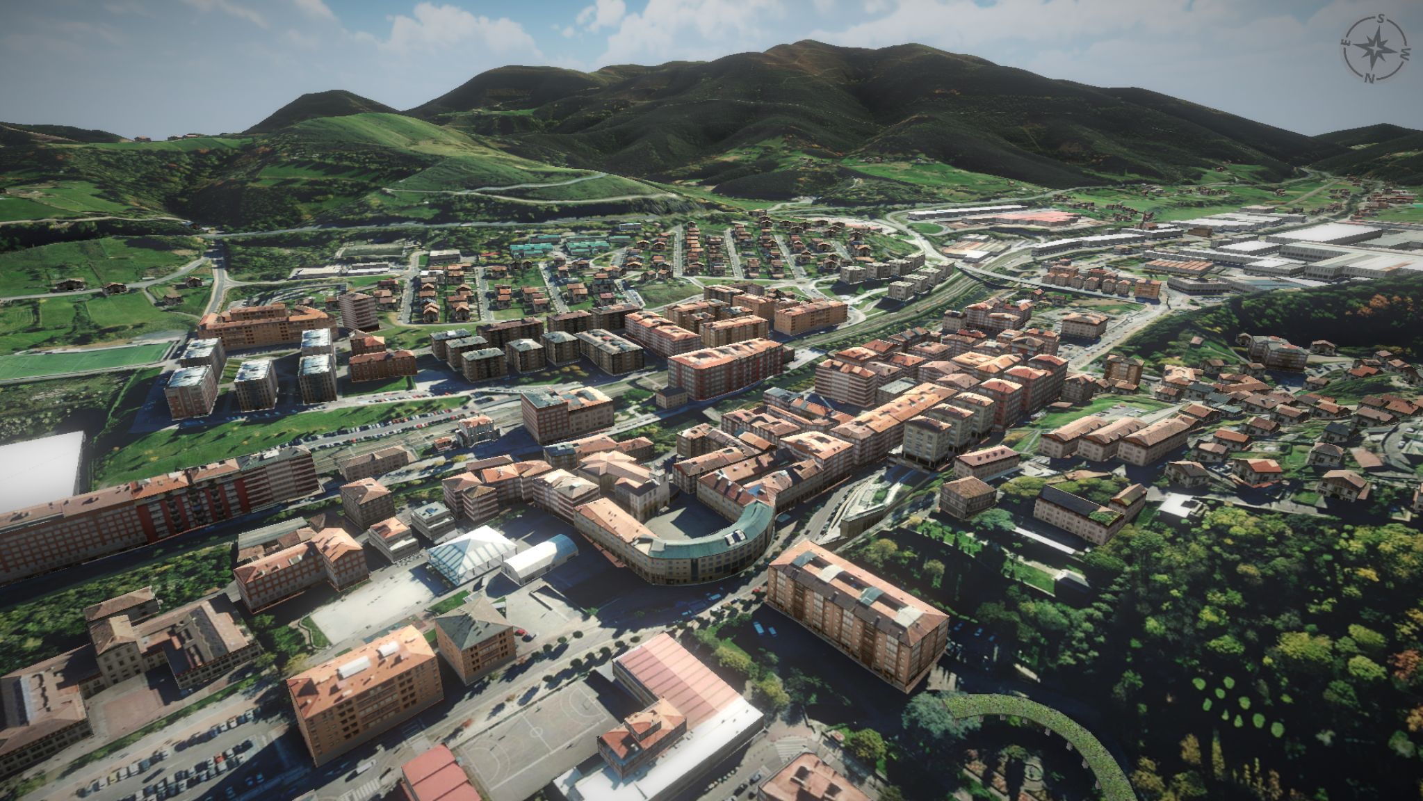
Virtual cadastral model of Llodio Town Hall.
3D visualisation of the municipality of Llodio with integrated search engine for cadastral properties with the aim of proposing a more visual and simple alternative to the current cadastral visualisers. It allows you to move freely around the municipality of Llodio to view any building from the outside. It also contains a cadastral search tool that allows us to access specific properties by sectioning the corresponding building by the selected floor and presenting the cadastral data of the same.
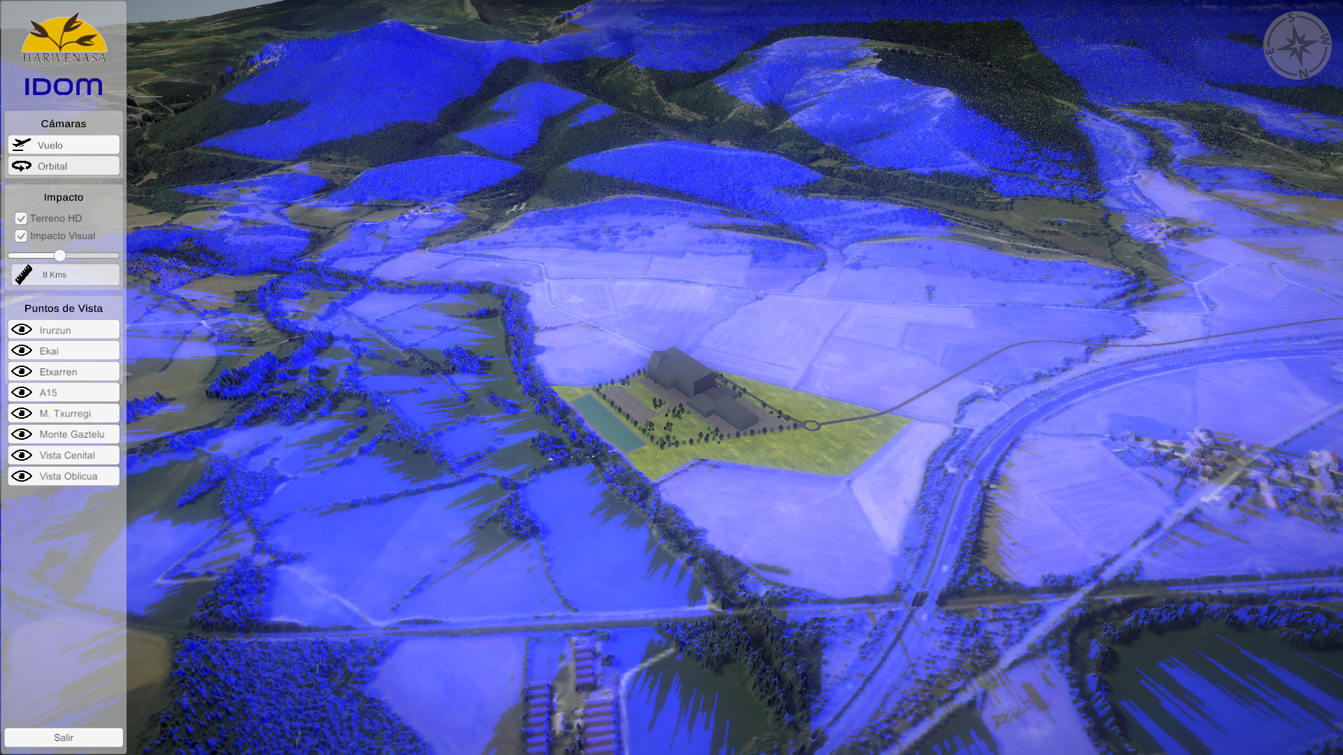
Virtual model of the Harivenasa factory in Irurzun.
3D visualisation tool of the Harivenasa factory in Irurzun and its surroundings in order to be able to analyse the visual impact on the environment. Here we can visualise the Harivenasa factory and its surroundings with complete freedom. In addition, we can simulate the area of visual impact by means of a blue mask that is applied to the terrain. The terrain can be visualised in low quality to improve performance and in high quality to see the real visual impact with the occlusion of buildings and vegetation in the surroundings.
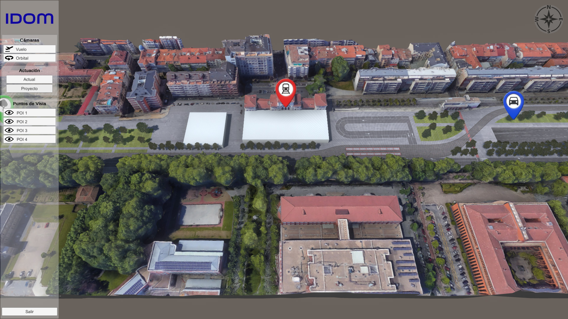
Virtual model of the Vitoria railway station.
Interactive tool for the visualisation of the Vitoria railway station underground works. The aim of this tool is to present the results of the underground works publicly in the Vitoria City Council. It visualises the before and after of the works by means of a simple interaction, being able to move freely and showing relevant data of the project.
Virtual model of the basic plan of the Gyeongnam region in South Korea.
Interactive tool for presenting the basic plan of the Gyeongnam region with the aim of presenting the uses of the different areas of the project. The project area is visualised interactively and with freedom of movement, with the possibility of selecting each of the different zones to visualise all the information.
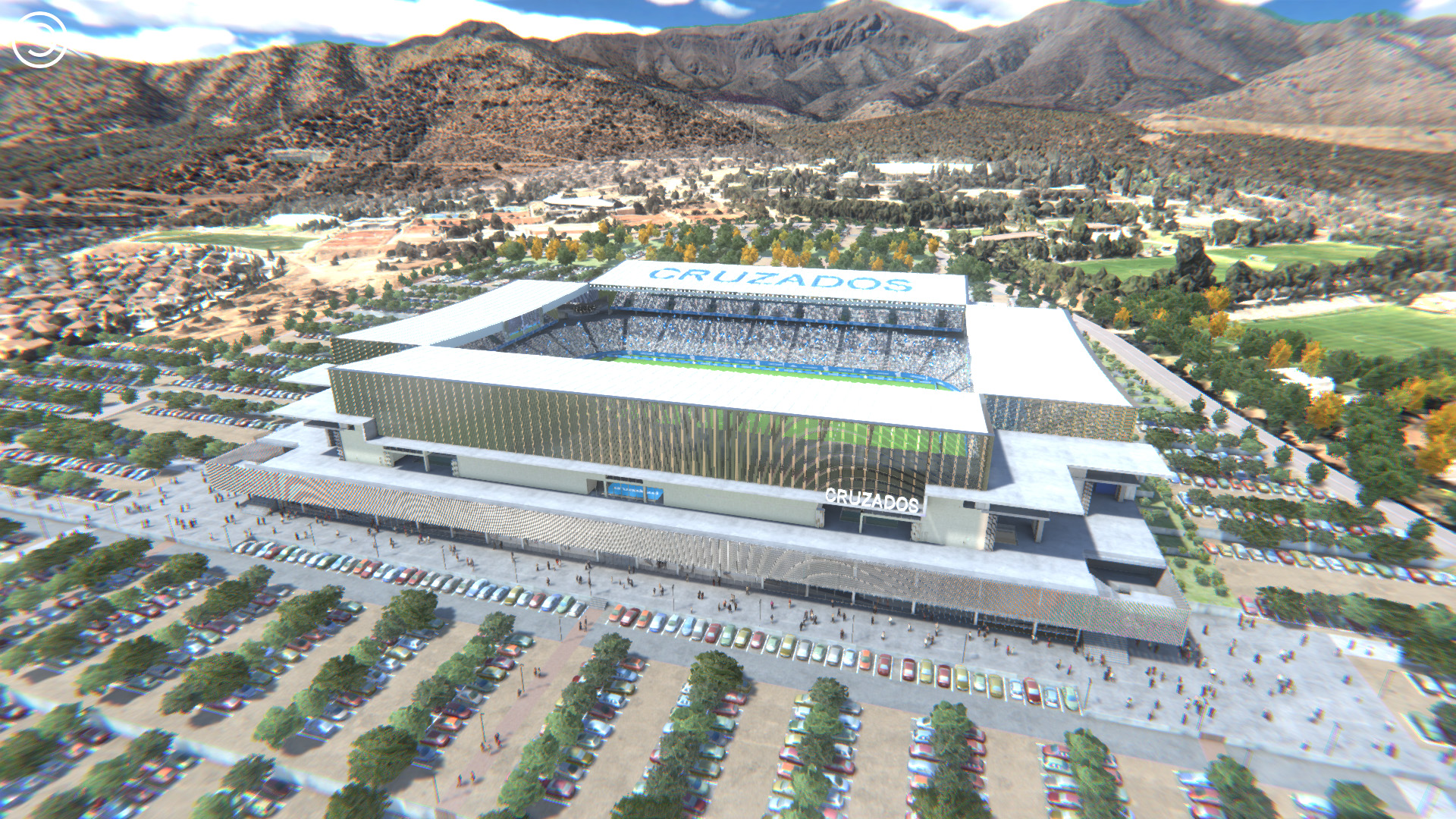
Virtual model of the San Carlos de Apoquindo stadium of the Crusaders’ club.
Virtual tool of the stadium in 3D for the visualisation of the project with total freedom of movement. The aim of this tool is to present the project in a public way showing the final result and the different uses of the facilities.
The tool has different tools that provide solutions for the club: interior/exterior visualisation, day/night visualisation, sections in model mode of the three axes, location of the members from their seats, visualisation of the lighting of the facilities, etc.