Regional program for reinforcing disaster risk management
El Salvador | Honduras
Regional program to reinforce disaster risk management in metropolitan areas of the Central American integration system: San-Salvador and the Central District of Tegucigalpa-Comayagüela
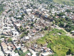
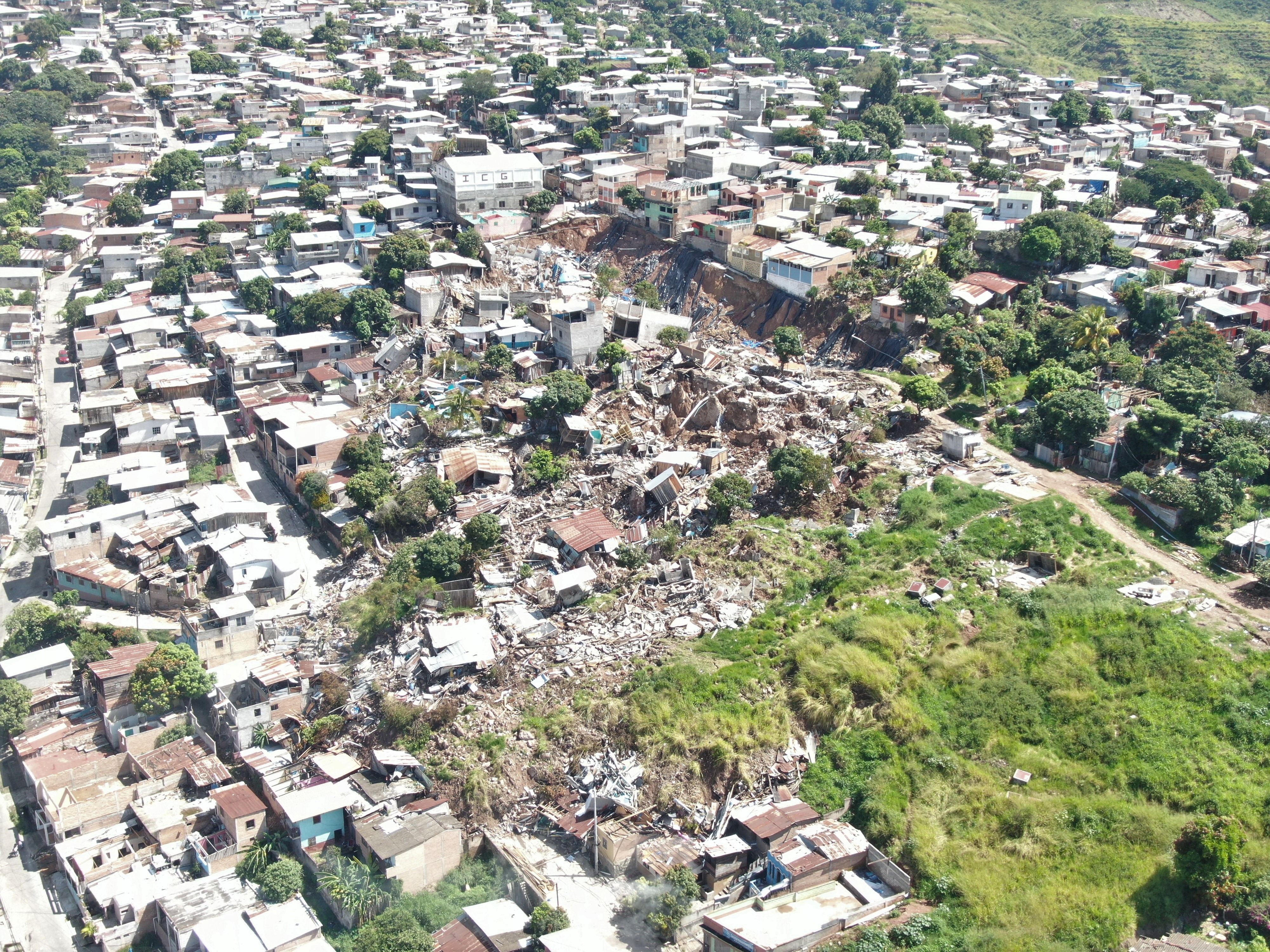
Despite its rich natural and cultural resources, Central America is regularly exposed to earthquakes, hurricanes, floods and other catastrophic events that test the tenacity and resilience of its inhabitants. The combination of its geographic location and climatic conditions makes it an epicentre of natural hazards, which highlights the need to comprehensively address mitigation, preparedness and response to such events to ensure the safety and well-being of Central American communities.
At IDOM, our main challenge is to provide technical assistance for the development of planning projects for disaster risk management in the metropolitan areas of San Salvador (AMSS) and the central district of Tegucigalpa-Comayagüela, focusing on projects that address flood and landslide risks, as well as capacity building for the technical profiles of municipalities.
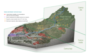
The IDOM Consulting team has devised a project based on the development of three tools to integrate the Disaster Risk Management (DRM) approach in the planning of both territories:
- Development of a management and governance plan for institutional alignment focused on a forward-looking DRM planning approach.
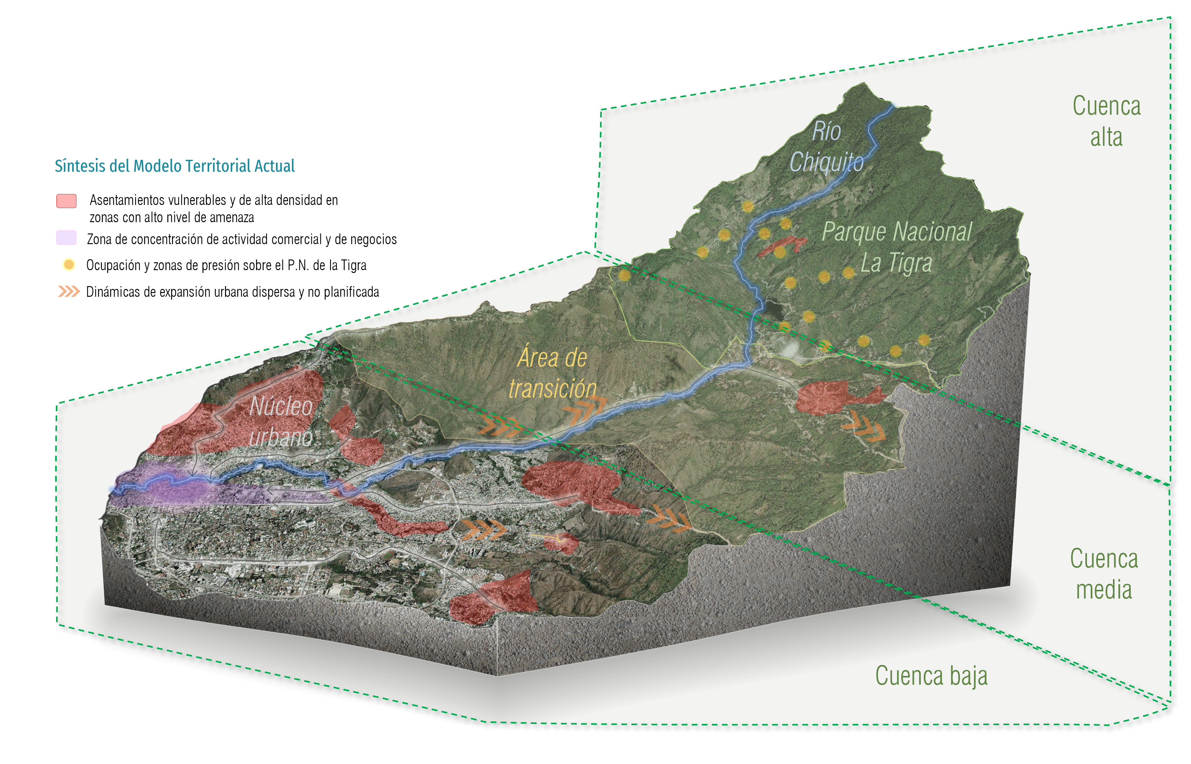
- Develop 4 pilot projects (2 of which will be implemented), oriented towards urban risk mitigation and adaptation in both metropolitan areas, which will serve as a model to be replicated in different contexts in the Central American region:
- Management Plan for the Chiquito River Sub-basin in Tegucigalpa, Honduras.
- Urban Partial Plan for the Picacho Este area in Tegucigalpa, Honduras.
- Sectoral Plan for urban flood management and control in Soyapango, San Salvador.
- Tool for mapping and characterization of vulnerability and risk in human settlements located in prioritized critical sites of the Acelhuate and Las Cañas river basins, San Salvador.
- Design a product for capacity building of key actors, so that they can have a forward-looking DRM approach, based on the tools acquired with this project.