


WATER
The hydrological cycle as a strategic pillar of urban planning: from rapid evacuation to integrated water management
OCTOBER 28, 2026
Nora Carolina Romero Sierra
Civil Engineer, MSc. in Hydrology and Water Resources Management | Linkedin
Historically, cities have been conceived as spaces designed to protect us from nature and control its effects. In this process, water transitioned from shaping the landscape to becoming a flow that had to be channeled, drained, and discharged as quickly as possible. This model enabled the growth of numerous urban centers. However, this approach is reaching its limits in a context marked by climate change and increased exposure to floods, droughts, and other extreme events.

“The city should be designed in harmony with water, recognizing the importance of the hydrological cycle in shaping its structure.”

According to the 2025 revision of World Urbanization Prospects, 57.8% of the world’s population lived in urban areas in 2025, a proportion that could reach 67.3% by 2050. This growth will increase pressure on established cities, whose water supply, sanitation, and drainage networks were designed for different demographic and climatic conditions. UNESCO notes that global demand for freshwater has grown at an annual rate of nearly 1% since the 1980s and estimates that the urban population exposed to water scarcity could increase from approximately 933 million in 2016 to between 1.7 and 2.4 billion by 2050. Similarly, the IPCC warns that climate-related risks to cities and their infrastructure will increase as global warming progresses.
Under natural conditions, some rain is intercepted by vegetation, some infiltrates the soil to help recharge aquifers, and the excess gradually reaches waterways. However, urbanization alters this process. Impervious surfaces reduce infiltration, increase runoff, and accelerate its flow into drainage systems. In coastal cities, this disruption is exacerbated by the influence of the sea. There, heavy rainfall can coincide with high tides or storms, hindering drainage. Additionally, rising sea levels can contribute to saltwater intrusion into aquifers and flooding. This creates an increasingly visible paradox: the same city may experience flooding during periods of heavy rain and, shortly thereafter, have difficulty ensuring water availability.
For decades, the primary response has been to increase the capacity of water infrastructure with collectors, canals, and other projects designed to transport water more quickly. While these measures will continue to be necessary, they are insufficient in the face of more uncertain climate scenarios. Adaptation also requires addressing land use, demand, water quality, and exposure to risk.
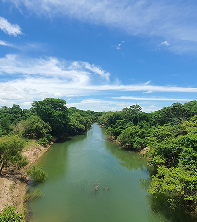
Water-Sensitive Urban Design (Water Sensitive Urban Design, WSUD), which emerged in Australia in the 1990s and was later linked to the water-sensitive cities paradigm, is an approach that integrates the management of stormwater, water supply, wastewater, watercourses, aquifers, coastlines, and ecosystems. This approach recognizes that every city is part of a watershed. Solutions such as permeable pavements, rain gardens, green roofs, urban wetlands, floodable parks, and stream restoration can be integrated through sustainable urban drainage systems and blue-green infrastructure networks. These solutions not only regulate runoff but also promote biodiversity, mitigate the heat island effect, and create more livable public spaces.
The goal is to replicate the pre-urbanization hydrological behavior as closely as possible. Some water can be reused, some can infiltrate the ground, and some must continue to rivers, wetlands, and other ecosystems that depend on it. To achieve this, we must reduce water losses in the distribution network, lower consumption, treat wastewater, and ensure that each use receives water of the appropriate quality. This change does not depend exclusively on incorporating new infrastructure. Water must be considered from the beginning of decisions about where to build, what development densities to adopt, and how to use the land. Topography, natural watercourses, floodplains, vegetation, and infiltration capacity should influence the city’s very shape.
This relationship has cultural and historical dimensions as well. A study by Delft University of Technology on the city of Kozhikode in India shows how ponds, wetlands, and canals can combine hydraulic, ecological, and community functions linked to the place’s identity. Designing water-sensitive cities requires understanding how water flows through the territory and how inhabitants have historically learned to live with it. From this perspective, frameworks such as the City Water Resilience Framework demonstrate that resilience requires integrating infrastructure, ecosystems, planning, financing, leadership, and social well-being.
The are examples that illustrate how these approaches can be implemented. For instance, Benthemplein Square in Rotterdam typically serves as a recreational space and can store nearly 1.8 million liters of water during heavy rains. The square is now part of the municipal program Rotterdams WeerWoord, which aims to integrate climate adaptation into urban planning by 2030 and ensure that Rotterdam is fully adapted by 2050. In Wuhan, the restoration of the Yangtze River ecological corridor incorporates flood protection, wetland restoration, environmental improvement, and riverbank revitalization for public use. The creation of the “La Marjal” Floodable Urban Park in Alicante not only solves flooding problems thanks to its capacity to retain up to 45,000 m³ of water during heavy rainfall events, but it also provides a recreational space for residents and promotes biodiversity.
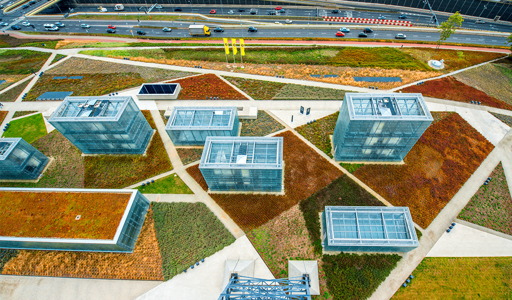
These examples are not universal solutions because resilience depends on each location’s geography, institutions, resources, and culture. However, they demonstrate that adaptation can be applied to existing cities by reinterpreting spaces to regain their hydraulic, ecological, and social functions. These projects also provide guidelines for future developments, showing that the water cycle should be integrated from the first planning decisions rather than being treated as a variable to be resolved at the end of the project.
Regenerating the city and planning its growth differently are two aspects of the same transformation. Perhaps the question that should accompany every new development and intervention in established urban areas is, “How much space are we willing to give back to water to ensure the safety and livability of our cities?”